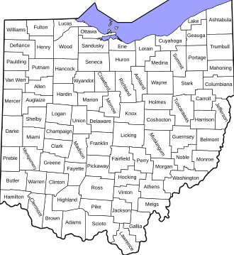
Full Statewide Coverage Across All 88 Ohio Counties
ALPI's continuous monitoring infrastructure now covers every Ohio county simultaneously, delivering minute-level data latency from notice of default through post-sale.
Products & services
Precision data and integration services for land, property and geospatial workflows.
→ Go to sectionALPI produces authoritative, analytically ready datasets across foreclosure activity, administrative boundaries, historical built environments, and terrain — delivered at the speed modern workflows demand.
ALPI was founded on the principle that data integrity is non-negotiable. Every commitment below is contractually enforceable by our clients.
Every record in ALPI's infrastructure is produced by deterministic, human-engineered pipelines. We do not use machine learning or AI models to infer, synthesize, or fill data gaps. What you receive is what the primary source contains — processed by code, validated by engineers.
Licensed clients receive access to 100% of the data we collect. ALPI will never withhold high-margin opportunities or selectively suppress records based on commercial interest. You see everything we see.
Our engineers sign a formal legal pledge to never knowingly submit false, inferred, or fabricated data. Every deployment is governed by a strict ethical and technical review process — ensuring that every dataset entering production meets the highest standard of integrity.
The latest engineering milestones, dataset releases, and product announcements from ALPI.
ALPI's continuous monitoring infrastructure now covers every Ohio county simultaneously, delivering minute-level data latency from notice of default through post-sale.
ALPI now delivers historical administrative boundary geometries spanning multiple decades, enabling institutional clients to model jurisdictional exposure and boundary change over time.
Recovery specialists and investment teams can now receive real-time case data directly inside their existing CRM workflows — no engineering lift required on the client side.
ALPI's automated ingestion and processing pipeline for Synthetic Aperture Radar imagery is now fully operational, continuously converting raw radar acquisitions into analysis-ready geospatial products.
ALPI is focused on extracting the hardest-to-reach land and property data there is. We blend GIS and data engineering techniques to build high-fidelity datasets that power criticial operations. Ground truth is our promise, every time.
ALPI's product suite spans foreclosure intelligence, time-series GIS data, historical building environments, terrain datasets, and satellite geocoding — with active coverage expansion across geographies and data types.
Share a few details about your practice or organization and we'll follow up with sample data and access options.