
Georeferenced footprints
Building outlines mapped to geographic coordinates and aligned with modern cadastral references for direct GIS integration.
Products & services
Precision data and integration services for land, property and geospatial workflows.
→ Go to sectionALPI provides precision intelligence datasets and managed integration services for analysts, investors, legal teams, government agencies, and geospatial engineering organizations.
End-to-end monitoring of every foreclosure lifecycle event across select states — from scheduled auction through final result, post-sale surplus, and case disposition.
| Attribute | Detail |
|---|---|
| Coverage | Select states — active coverage |
| Pre-auction window | Up to 60 days |
| Data latency | Seconds to minutes from event-time |
| Enrichment | AVM, loan balance estimate, skip-traced contacts |
| History | Case history retained indefinitely |
| Delivery | API, CRM push, database delivery |
Georeferenced historical building footprints with vintage dating and structural attributes, supporting heritage assessment, urban planning, and investment due diligence.
Building outlines mapped to geographic coordinates and aligned with modern cadastral references for direct GIS integration.
Each structure is dated to its construction or first documented appearance, enabling temporal analysis of built environment change.
Available attributes include occupancy class, construction material, and floor count where source data permits.
Authoritative resolution of named places and geographic features to latitude/longitude coordinates, drawn from curated gazetteer sources with provenance tracking.
Coordinates are derived from authoritative government and institutional gazetteers, not crowd-sourced or inferred from address matching heuristics.
Covers populated places, water features, landforms, parks, transportation nodes, and administrative units.
Every coordinate record includes source attribution and confidence metadata to support audit and reproducibility requirements.
ALPI deploys production-grade, continuous DEM generation pipelines for clients with access to L0 sensor datasets — from raw point cloud ingestion through noise filtering, surface correction, and curated tiled delivery. We configure, validate, and maintain the full stack.


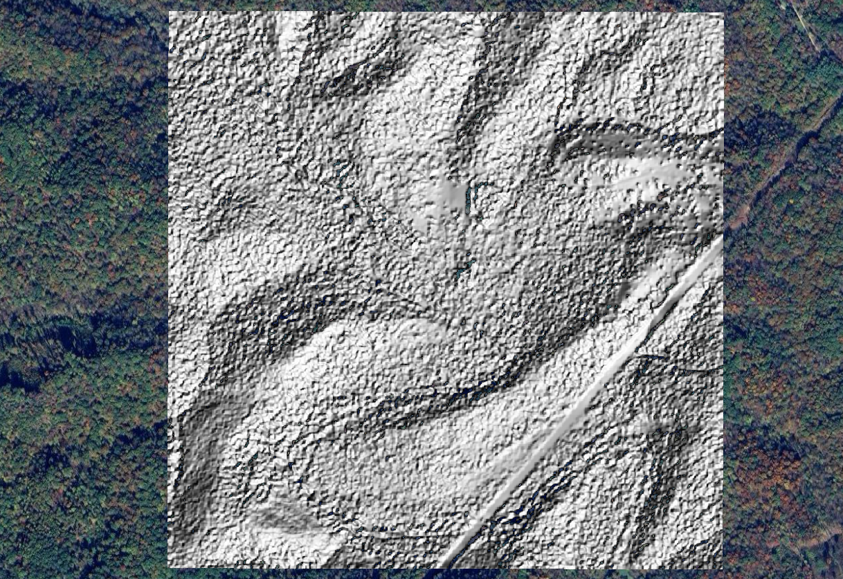
ALPI deploys and maintains the full DEM processing stack for your L0 sensor data — whether from airborne LiDAR, UAS photogrammetry, or spaceborne altimetry. Each pipeline stage is containerized, versioned, and continuously validated against reference benchmarks.
Coverage area and resolution are defined by your sensor input. Sub-meter to 5m spatial resolution is achievable depending on platform. Slope, aspect, hillshade, and watershed delineation are available as pre-computed derivative layers.
All outputs are delivered as Cloud-Optimized GeoTIFF with embedded spatial reference and vertical datum metadata. Custom tiling schemes and area-of-interest clipping are supported to fit existing downstream workflows.
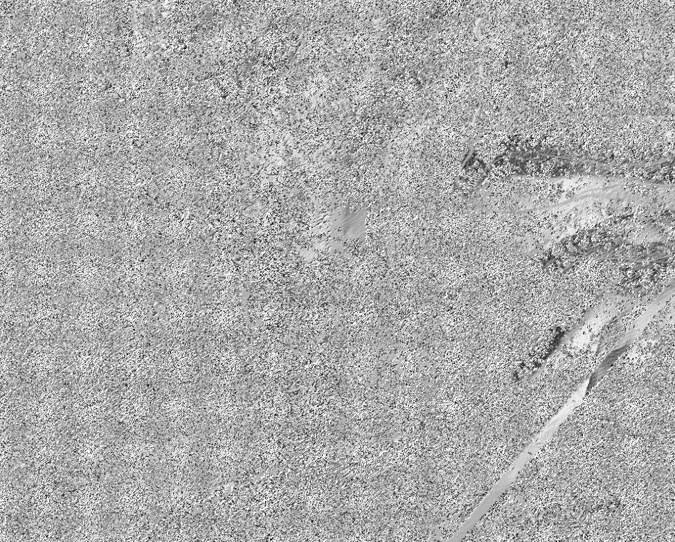
Automated, production-grade processing pipelines for Synthetic Aperture Radar (SAR) imagery — from raw sensor acquisition through analysis-ready deliverables — deployed via continuous integration and continuous delivery practices.
ALPI's SAR pipelines ingest raw radar acquisitions and apply standardized radiometric correction, geometric registration, and speckle filtering — producing consistently structured outputs across sensor platforms and acquisition geometries.
The pipeline architecture follows CI/CD principles: each processing step is versioned, containerized, and automatically tested on ingestion. New acquisitions enter the pipeline and emerge as analysis-ready products with no manual intervention.
Delivered products include calibrated backscatter imagery, coherence maps for change detection, and terrain-corrected outputs suitable for direct GIS integration. All products carry standardized metadata: acquisition date, sensor, polarization mode, orbit direction, and processing provenance.
Managed services to connect ALPI data into your existing workflows without in-house engineering effort.


End-to-end managed integration between ALPI data feeds and your CRM or internal database. Includes schema mapping, pipeline build, initial delivery, and ongoing maintenance. Compatible with GoHighLevel, Monday.com, Salesforce, HubSpot, Airtable, and custom REST endpoints.
Programmatic access to all ALPI datasets via REST API with scoped API keys, consistent schemas, and full developer documentation. Suitable for internal tooling, client-facing products, and analytics pipelines.